
Reading mountain weather isn’t about memorizing cloud types; it’s a flawed approach that misses most environmental traps. True safety for independent hikers comes from adopting a dynamic risk assessment system. This guide, from a search and rescue perspective, reframes weather prediction from a passive observation into an active process of identifying failure points, understanding terrain interplay, and making critical decisions before the environment makes them for you.
The allure of an alpine environment is its raw, untamed beauty. A ridge bathed in morning sun, a valley filled with mist—these scenes draw us off the beaten path. Yet, for every stunning vista, there’s a hidden environmental trap. Most hikers believe they are prepared because they’ve checked the forecast and can spot a dark cloud. They rely on simple rules of thumb like “be off the summit by noon.” From a search and rescue standpoint, we know these platitudes are dangerously incomplete. They create a false sense of security and fail to account for the complex interplay of terrain, timing, and human factors.
The truth is, catastrophic situations in the mountains rarely stem from a single, sudden event. They are the result of a failure cascade, a series of small, seemingly minor misjudgments. But what if the key wasn’t just recognizing a weather sign, but understanding the entire system that produces it? What if safety wasn’t about a checklist, but about a mindset? This guide moves beyond the basics of weather watching. We will dismantle common misconceptions and build a robust mental framework for risk assessment, focusing on the subtle traps and counter-intuitive principles that separate a challenging day from a rescue call.
We’ll explore why seemingly stable slopes hide significant danger, how to make your map your most reliable tool when technology fails, and how to choose the right emergency device for the terrain you’re in. We will dissect the critical timing mistakes that lead to lightning exposure and build a survival kit that prioritizes function over weight. Finally, we’ll examine how new technology fits into this system and unpack the most common—and dangerous—layering mistake hikers make. This is about building true operational awareness in the mountains.
Summary: A Systematic Approach to Mountain Weather and Survival
- Why scree slopes are more dangerous than they look?
- How to use a topographic map when GPS fails?
- PLB vs Satellite Messenger: which works best in deep valleys?
- The timing mistake that exposes hikers to afternoon lightning
- What to include in a survival kit that weighs under 500g?
- Why satellite internet is finally a viable option for heavy video calls?
- The layering error that leaves you freezing despite a down jacket
- Why lack of green space exposure increases anxiety in adults?
Why Scree Slopes Are More Dangerous Than They Look?
Hikers often perceive scree or talus slopes as a simple, albeit tiring, obstacle. The danger seems obvious: loose rock underfoot. However, the real threat is far more insidious and often invisible. The stability of these slopes is not constant; it’s a dynamic system influenced by factors that occurred days or even weeks prior. The most dangerous environmental traps are the ones you don’t see coming. A slope that appears dry and stable on a sunny day may be critically primed for failure due to past rainfall that has saturated the soil and bedrock beneath the loose surface rock.
This is because the rockfall itself is just a symptom. The underlying cause is often water pressure building up in soil pores and rock fractures, reducing the internal friction that holds the slope together. As a result, the trigger for a slide can be surprisingly small. Research confirms this hidden risk, showing that about 50% of landslide events occur with no rain or only light rain on the day of the disaster. The “time bomb” was set days before. Your own weight traversing the slope can be the final, fatal trigger.
A catastrophic example of this principle was seen in the mountains of the Southeast US, where Hurricane Helene triggered over 2,000 landslides. In one case, a series of four successive debris flows completely obliterated a small town, demonstrating how intense, saturating rainfall can reactivate ancient slide paths and turn a seemingly solid mountainside into a fluid, unstoppable force. For a hiker, this means treating every steep, unconsolidated slope with extreme caution, regardless of the current weather. The real weather to consider is the weather of the past week, not just the past hour. This is the first principle of a dynamic risk assessment system: looking beyond the immediate conditions.
How to Use a Topographic Map When GPS Fails?
In a whiteout or dense forest, your GPS is a godsend—until the battery dies, the signal is lost in a deep canyon, or the device fails. At this moment, your topographic map and compass transform from backup tools into your primary survival system. This is the core principle of analog redundancy: a non-negotiable part of any backcountry risk management plan. But using a map effectively in zero visibility isn’t about simply finding your location; it’s about continuously maintaining situational awareness by actively cross-referencing the map with the subtle clues your environment provides.
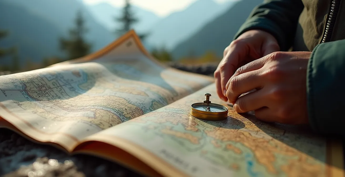
The most powerful technique is terrain association. You must learn to “feel” the map with your feet. Are the contour lines on the map tightly packed? You should be feeling a steep ascent. Are they widely spaced? The ground beneath you should be relatively flat. By constantly comparing the angle of the slope you’re on with the contour lines on your map, you can track your progress and confirm your position even without clear landmarks. The wind itself becomes a compass. If the morning forecast called for a westerly wind, and you can feel it on your left cheek, you are heading roughly north. This provides a constant, reliable bearing to orient your map and your direction of travel.
Your Map-Based Situational Awareness Checklist
- Orient & Associate: Align your map to north with a compass, then match the contour lines directly in front of you with the slope you can see or feel underfoot.
- Reference the Wind: Use the forecast wind direction (e.g., “from the west”) as a constant bearing. If it’s on your left, you’re moving north.
- Identify Microclimates: Before you even start, use the map to spot potential weather traps. North-facing slopes will hold ice longer; gullies and valleys will funnel wind, creating dangerous wind chill.
- Pre-plan Escape Routes: Mark at least two bail-out routes on your map that lead to lower elevations or shelter before you begin your ascent. Know your “decision points” to use them.
- Scan the Horizon: Every 15 minutes, stop and scan the horizon for changes in cloud formations. Compare what you see to what you expected from the forecast.
A topographic map is not just a picture of the land; it is a predictive tool. It tells you where microclimates exist that can create localized, severe weather not captured in a regional forecast. This level of analysis elevates the map from a simple navigational aid to the cornerstone of your risk assessment system.
PLB vs Satellite Messenger: Which Works Best in Deep Valleys?
Carrying a personal emergency device is a standard part of a modern hiker’s kit. However, the choice between a Personal Locator Beacon (PLB) and a satellite messenger is a critical decision that depends entirely on your environment. Both can save your life, but they operate on fundamentally different principles, and understanding this difference is key. The common assumption is that two-way communication from a satellite messenger is always superior. In a deep valley or under dense tree canopy, this assumption can be a fatal mistake.
A PLB is a one-trick pony, but it performs that trick with incredible reliability. When activated, it sends a powerful 5-watt distress signal to the Cospas-Sarsat satellite network, a robust, government-run system dedicated solely to search and rescue. A satellite messenger, by contrast, operates on a commercial network (like Iridium or Globalstar) and uses a much weaker 1.6-watt transmitter. This power difference is the single most important factor in challenging terrain. The stronger PLB signal has a significantly better chance of “punching through” a dense forest canopy or being picked up from the bottom of a narrow canyon where sky view is limited. As the Colorado Search and Rescue Association highlights, PLBs simply have superior communication ability in obstructed environments due to this power advantage.
This technical difference has practical implications for your choice. A detailed comparison of PLB and satellite messenger performance makes the trade-offs clear.
| Feature | PLB | Satellite Messenger |
|---|---|---|
| Signal Power | 5 watts | 1.6 watts |
| Canopy Penetration | Better (higher power) | Limited |
| Battery Life | 5-7 years standby | Days to weeks (rechargeable) |
| Subscription Required | No | Yes ($12-50/month) |
| Two-way Communication | No | Yes |
| SOS Cancellation | Not possible | Yes |
The ability to send “I’m okay” messages or have a two-way text conversation with rescuers is a powerful feature of satellite messengers. However, from a SAR perspective, our first priority is receiving the initial distress signal. In deep valleys, dense forests, or severe weather, the reliability of the signal outweighs the convenience of communication. Therefore, the choice is strategic: if your primary concern is an absolute last-resort emergency signal in the most challenging terrain, a PLB is the more robust tool. If you value communication and tracking in more open terrain, a messenger may be suitable.
The Timing Mistake That Exposes Hikers to Afternoon Lightning
“Be off the summit by noon” is one of the oldest and most repeated adages in mountaineering. While it’s a sound starting point, treating it as an inflexible rule is a critical timing mistake. It fosters a dangerous complacency. The real risk of afternoon thunderstorms is driven by solar heating and convection, a process that has its own daily timetable, but one that can be accelerated or delayed by a host of local factors. Relying solely on the clock, instead of observing the atmospheric story unfolding above you, is how experienced hikers get caught.
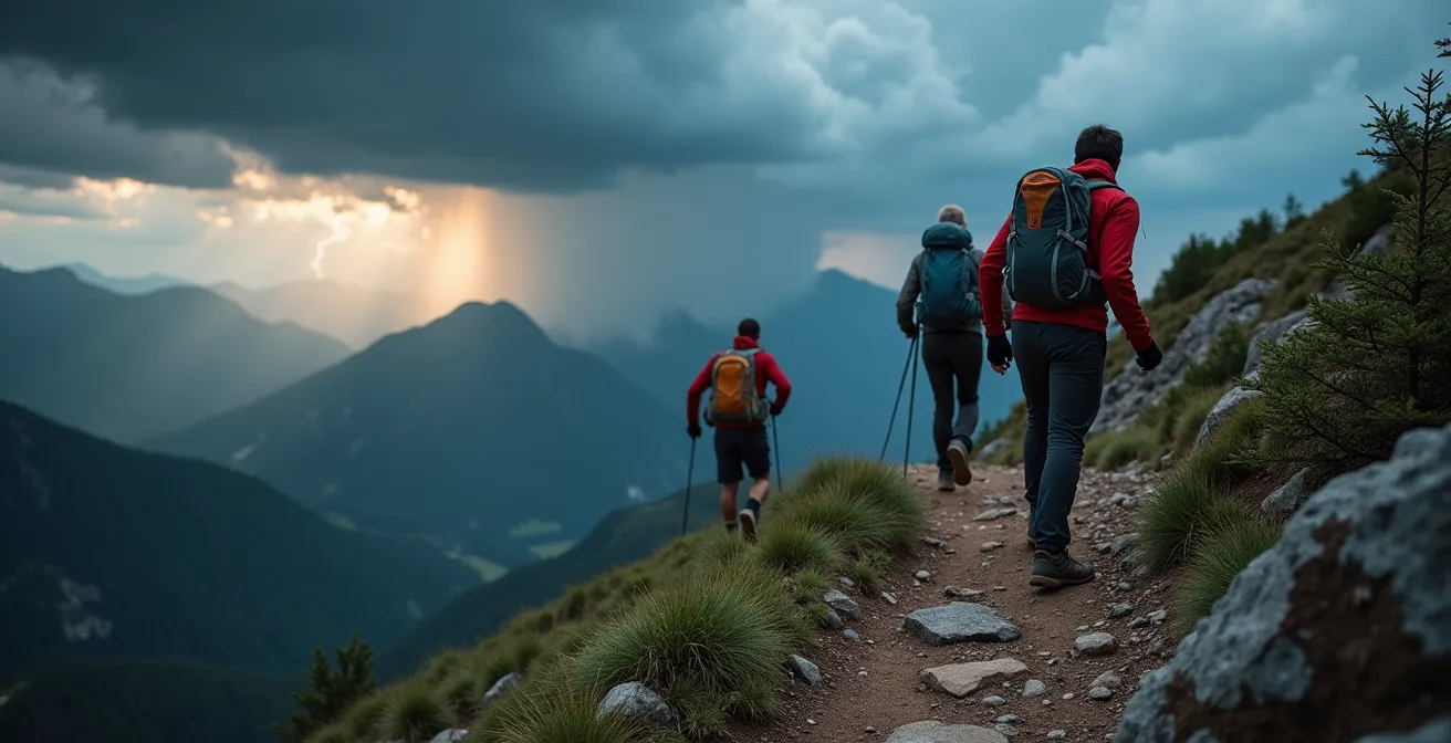
In many mountain ranges, the process begins early. The morning sun heats the east-facing slopes, causing air to rise. This rising air contains moisture, and as it cools, it condenses into puffy, benign-looking cumulus clouds. This is your first warning sign. These are the “pioneer” clouds of a potential storm. If they continue to grow vertically throughout the morning, developing into towering cumulus with sharp, defined edges, they are building energy. This is your second, more urgent warning. The transition from these to a full-blown cumulonimbus (thunderstorm) cloud can happen with frightening speed. Many hikers ignore these building stages, focused only on their “noon” deadline.
An analysis of weather patterns on Colorado’s high peaks provides a stark illustration of this. It shows that while the highest probability of lightning is indeed in the afternoon (between 2 PM and 8 PM), the risk can begin as early as 10 AM on some days. The “summit by noon” rule would have left hikers exposed for two hours already. The correct rule is to be heading down at the first sign of significant vertical cloud development, regardless of what time it is. You must also know the 30/30 rule: if you can count less than 30 seconds between a lightning flash and the sound of thunder, the storm is close enough to strike you. You should be in a safe location and wait 30 minutes after the last clap of thunder before moving on.
What to Include in a Survival Kit That Weighs Under 500g?
A survival kit is not a collection of random gear; it’s a lightweight, integrated system where each item serves multiple purposes to combat the primary threats in an unplanned night out: hypothermia, getting lost, and dehydration. The goal is to manage your body’s core temperature and signal for help effectively. Forget the oversized knives and complex gadgets. A sub-500g kit built with a SAR mindset focuses on high-efficiency, low-weight items that directly address weather-related survival priorities.
The cornerstone of this kit is shelter and heat retention. An emergency bivy bag is non-negotiable. Weighing as little as 90g, it’s a waterproof, windproof barrier that reflects up to 90% of your body heat back to you. This is far more effective at preventing hypothermia than an extra fleece jacket. A heavy-duty trash compactor bag is another essential, multi-use item. It serves as a waterproof pack liner during the day and can become an emergency poncho, a rain shelter, or a tool for collecting rainwater or dew.
Signaling is the next priority. A mirror is great on a sunny day, but useless in fog or at night. A simple chemical light stick is far more versatile and visible in low-light, adverse weather conditions. Likewise, a pea-less whistle is critical. The sound from a good whistle carries much farther than a human voice in dense fog or high winds. Finally, you need a guaranteed way to make fire. This means a storm-proof lighter or ferro rod, coupled with waterproof tinder. The ability to create fire provides warmth, a psychological boost, and a powerful nighttime signal.
- Emergency Bivy (approx. 90g): Your primary defense against hypothermia.
- Heavy-Duty Compactor Bag (approx. 50g): Multi-use waterproofing and shelter.
- Storm-Proof Fire Starter & Tinder (approx. 40g): Guaranteed fire in any condition.
- Mini Altimeter/Thermometer (approx. 30g): Allows you to track barometric pressure drops, an excellent indicator of an approaching storm.
- Pea-less Whistle (approx. 20g): The most effective audible signal in poor visibility.
- Chemical Light Stick (approx. 25g): A reliable visual signal for night or fog.
- Remaining Weight (approx. 245g): Allocated for a small, personalized first-aid kit, water purification tablets, and a high-calorie emergency food bar.
This minimalist kit is not about comfort; it’s about providing the critical functions needed to survive a severe weather event or an unexpected night in the mountains until help arrives.
Why Satellite Internet Is Finally a Viable Option for Heavy Video Calls?
While traditional survival focuses on robust, simple tools, it’s impossible to ignore the rapid evolution of communication technology. The advent of low-Earth orbit (LEO) satellite internet, pioneered by services like Starlink, is changing the connectivity landscape, even in remote mountain regions. For professionals or long-term expeditions, this means the ability to conduct high-bandwidth activities like video calls from a backcountry basecamp is now a reality. But from a search and rescue and safety perspective, what does this technology truly mean for the average hiker? Is it a game-changer or a dangerous distraction?
The primary advantage is access to data-rich information in real-time. A hiker with a satellite internet connection could, in theory, access live Doppler weather radar, download high-resolution forecast models, or even have a video consultation with a wilderness medicine specialist about a weather-related injury like frostbite. This level of information is far beyond what a simple satellite messenger can provide. Emerging technologies like Starlink’s Direct to Cell, which aims to provide standard LTE service from space, promise even more ubiquitous connectivity in the near future.
However, this capability comes with significant vulnerabilities. These systems require a clear view of the sky, making them unreliable in deep canyons or dense forest—the very places where emergencies often happen. Their dishes are susceptible to signal loss from heavy snow or ice accumulation. Most importantly, they are power-hungry systems that require setup time and a stable power source, a luxury you do not have in a true survival situation. For this reason, satellite internet should be seen as a powerful tool for planning and information gathering at a basecamp, but it absolutely does not replace a dedicated, instant-on emergency device like a PLB. It is a supplement to, not a substitute for, a robust, multi-layered safety system.
Key Takeaways
- Terrain is Weather: Danger isn’t just in the sky. The stability of slopes and the shape of valleys are critical weather factors that are often overlooked.
- Analog Redundancy is Non-Negotiable: Technology fails. Your ability to use a map and compass is not a backup plan; it’s a primary, co-equal system.
- Heat Management is Counter-Intuitive: Preventing heat loss from wind (convection) is often more important than insulation thickness. A lightweight wind shell can be more effective than a heavy down jacket when you’re moving.
The Layering Error That Leaves You Freezing Despite a Down Jacket
Every hiker knows the basics of layering: a base layer to wick sweat, a mid-layer for insulation, and a shell to block wind and rain. Yet, one of the most common scenarios leading to hypothermia involves hikers who are wearing all the right gear, including a high-quality down jacket, but are still dangerously cold. This paradox stems from a fundamental misunderstanding of heat loss. The layering error isn’t about what you wear, but *when* you wear it. Specifically, it’s the failure to manage moisture from the inside out.
Your body is a furnace. When you’re hiking uphill, you generate a massive amount of heat and sweat. If you wait until you feel hot to remove a layer, your base and mid-layers are already damp. When you stop for a break or the wind picks up, that moisture becomes a conductor, rapidly pulling heat away from your body. Putting a big down jacket on over damp layers is like trying to insulate a wet wall—the insulation gets compromised and you get cold from the inside. The down jacket traps the moisture, creating a personal, freezing microclimate against your skin.
The key is proactive heat management, not reactive layering. An illuminating field test in windy conditions demonstrated that a lightweight, 150g windproof shell provided far superior warmth than a 500g down jacket. Why? Because the wind shell prevented convective heat loss—the wind stripping away the pocket of warm air your body creates—without causing overheating and sweating. This is the crucial, counter-intuitive insight: in many conditions, especially when you are active, preventing wind from stealing your heat is more important than adding more insulation.
- Start Cold: Begin your hike feeling slightly chilly. You will warm up within 10 minutes of movement. If you start warm, you will be sweating in 15 minutes.
- Make Micro-Adjustments: Unzip pit-zips, roll up sleeves, or remove your hat *before* you feel yourself starting to sweat.
- De-layer on Ascents: Take off your insulating mid-layer before you start a steep climb, not halfway up it. Pack it away. You can always put it back on at the top.
- Prioritize the Wind Shell: When the wind picks up, your first move should be to add your windproof shell, not your puffy jacket. This traps your existing warmth without causing you to overheat.
This “Start Cold” strategy shifts the focus from adding layers for warmth to removing them to stay dry. It’s a core discipline of an effective mountain risk assessment system.
Why Lack of Green Space Exposure Increases Anxiety in Adults?
In our final analysis, we turn from the technical to the psychological. The act of venturing into the mountains is often a search for peace, a way to disconnect from urban anxiety. Yet, the unpredictable nature of mountain weather can, paradoxically, become a new source of intense anxiety. A sudden change in the sky, the distant rumble of thunder—these can trigger a primal fear that erodes the very sense of calm we seek. The question then becomes, how do we engage with this powerful environment without being controlled by the anxiety it can provoke?
The answer lies in transforming ignorance into competence. Environmental anxiety often stems from a feeling of powerlessness in the face of immense natural forces. When you don’t understand the “language” of the mountains, every dark cloud is a potential catastrophe, and every gust of wind is a threat. You are operating from a place of reactive fear. This is where the risk assessment system we’ve been building throughout this guide becomes more than just a survival tool; it becomes a form of therapy.
Learning to interpret weather patterns is a form of cognitive behavioral therapy for environmental anxiety, replacing catastrophic thinking with calm, data-driven decision making.
– Michael DeYoung, Former Air Force meteorologist
By learning to read the signs—the vertical growth of clouds, the stability of a slope, the drop in barometric pressure—you are no longer a passive victim of the weather. You become an active participant in a dialogue with the environment. You can anticipate, plan, and act with confidence. The fear of the unknown is replaced by the respect for the known. This cognitive shift is profound. It allows you to appreciate the beauty and power of the mountains not with anxiety, but with a calm, earned awareness. You’ve replaced a vague sense of dread with a specific, actionable set of knowledge. This is the ultimate goal: to be safe not just in body, but in mind.
The principles outlined here are not just a checklist, but a new way of thinking in the backcountry. Adopting this proactive, systematic approach to risk management is the most important step you can take to ensure your adventures end with a safe return, ready for the next one.
Frequently Asked Questions About How to Read Mountain Weather Patterns to Avoid Getting Stranded?
How does satellite internet improve mountain safety beyond basic emergency beacons?
High-bandwidth connections allow real-time weather radar access, video consultations with wilderness medicine specialists for weather-related injuries, and direct consultation with meteorologists for complex weather pattern analysis.
What weather-related vulnerabilities affect satellite internet systems?
Heavy snow and rime ice accumulation on dishes can block signals, extreme cold affects power systems, and dense wet clouds can degrade signal quality during storms.
Can satellite internet replace traditional emergency beacons?
No, satellite internet should complement, not replace, dedicated emergency devices. Internet systems require power, setup time, and clear sky view, while PLBs work instantly with stronger signals.